Garrett and I send our greetings from Rutland, Vermont where we are supplying after finishing the first leg of the Long Trail. Over the last 7 days we have hiked 103 miles from North Adams, MA to Vt Rte 4. The Long Trail is a 270 mile trail running the vertical length of the state of Vermont to its terminus at the Canadian border. The Long Trail is the oldest long-distance trail in the country and so at its naming in 1910, it was indeed a long trail unlike any other. The trail for this first leg as overlapped with the Appalachian Trail, so we got to revisit many familiar sites. It was neat hiking from the opposite direction (we southbounded the AT in 2006) because everything looked a little different.
Our first four days out were basically a wash with heavy rain or drizzle each day and often all through the night. The trails are steep and muddy which makes for an interesting combination. There are lots of rocks and roots to hop from which is a nice to way to TRY to avoid the mud, but also makes for a hard hike physically and mentally as you think about each step's strategic placement. And then every tenth step you mistake a lump of mud for a rock and bury your foot in suction-cup like thick mud and wonder why you bother placing your steps at all!
During these first days the trail was crowded with other Long Trailers and AT hikers. Shelter space was at a premium as some hikers stayed for several days at a time in one shelter to avoid hiking in the rain. We were lucky to squeeze into a shelter each night and avoided having to tent in the rain. It's been great to meet lots of hikers and hear everyone's story.
 |
| Posed photo mimicking one taken here seven years ago as we hiked south on the AT. The VT/MA border is the beginning of the Long Trail. |
 |
| Long Trail sign.... and a soggy start! |
 |
| Overlooking a former beaver pond whose dam must have washed out during Irene. Now it's a green field. Also, it was a little windy! |
 |
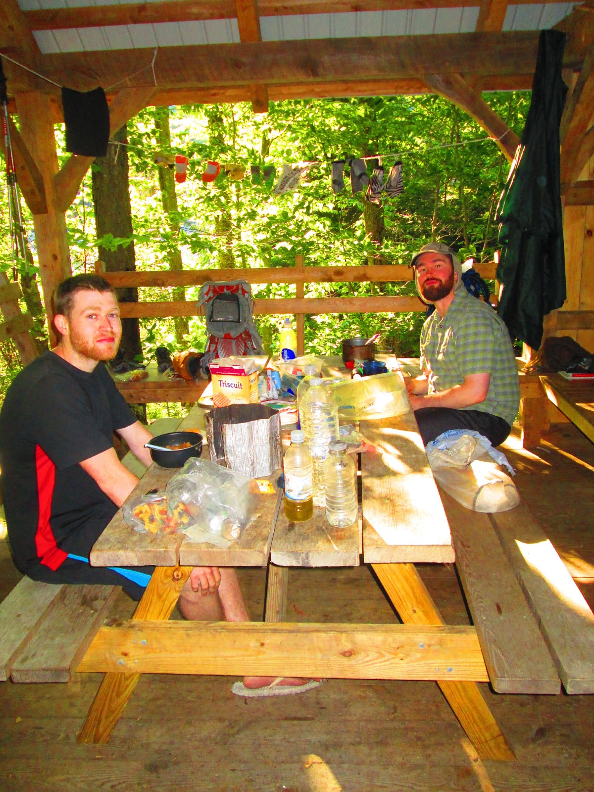
| Shelters like these are placed about every 6-8 miles making nice lunch and break points OUT of the rain. |
 |
| It was nice to be with an old friend. |
 |
| Big boulders make the trail fun. I thought this one looked like a sailboat. |
 |
| This is the Goddard Shelter. We have a black and white picture of this shelter on our living room wall and when we came up to it unexpectedly, it was a wonderful surprise. |
 |
| The Long Stream......I mean Trail. |
 |
| Bending tree |
 |
| The sun came out on the fifth day!! |
 |
| The trail overlaps with the Catamount Trail for a bit around Stratton Mountain. The Catamount trail is a X-C ski trail that runs the length of VT (a dream for some winter adventure). |
 |
| Bromely Mt with its spaceship-like lift. |
 |
| Looking super-hero-ish as I dry my poncho in Bromley's wind. |
 |
| We met up with a another Long Trailer and former AT thru-hiker named Samson. We've been hiking with him for the last three days. Here we are crossing a stream where a bridge washed out in Irene. |
 |
| Ah, a sunny lake and a foot-soaking after a long day. |
 |
| Samson and Garrett enjoying a beautiful shelter at Little Rock Pond. |
 |
| White Rock Mtn has lots of these stacks of white rocks left by other hikers. |
 |
| Just a shot of Garrett filtering our water. |
 |
| Climbing out of Clarendon Gorge. |
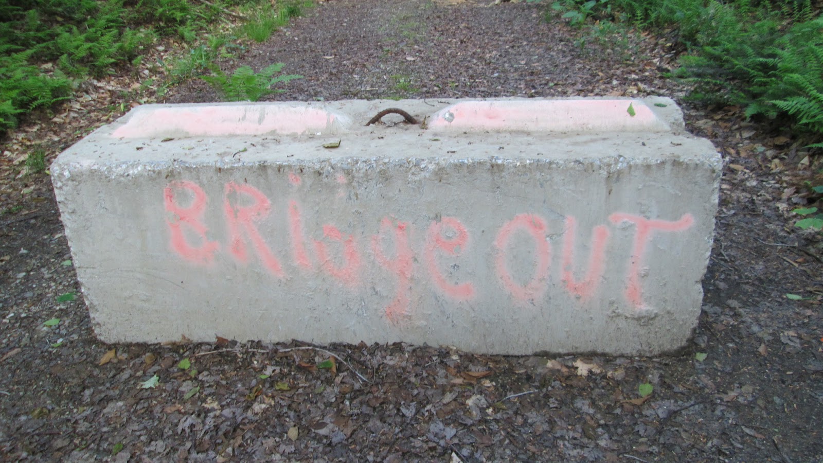 |
| There is a lot of Hurricane Irene damage still. |
 |
| Looks like it would make some excellent card-making material for a certain holiday which just passed on Sunday. |
 | ||
| Here in Rutland at the Twelve Tribes hostel where Garrett is trying to glue together his spork and tooth brush head to make a multi-purpose tool. For pictures of the final product you will have to stay tuned. |
Rutland is a great place to stay for a night and we are all resupplied and tanked up for the next leg. We even saw Garrett's college friends Nelson and Molly randomly in town and got to enjoy dinner together last night.
Have a great week!
1 comment:
Looks like the Long Trail is going well even with the wet conditions. Thanks for my great Fathers Day card, it was very original and Green, Stay Well!!
Post a Comment